What Is GeoMoose?
GeoMoose is a JavaScript library you can use to show mapping data in your browser. The great thing about GeoMoose is that just by editing an XML file and tweaking a little JavaScript you can configure GeoMoose to show a full featured web map interface with the layers you choose.
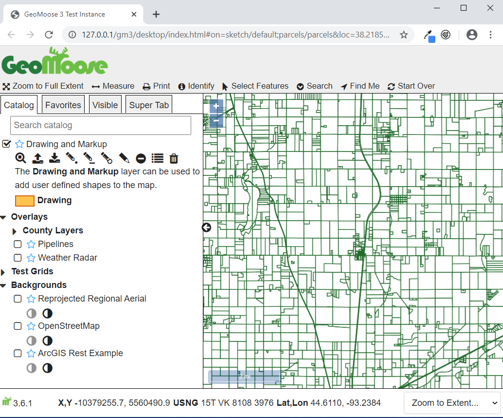
GeoMoose GUI
What can GeoMoose do?
You can configure GeoMoose to:
show buttons for zooming, measuring, and printing
show attributes of geographical features by a single click
search features by attribute values
list and group layers in a catalog layer control
use a drop down list for zooming to specific locations
show cursor coordinates in Lat/Lon, projected, and USNG reference systems
draw features (with save and load) for marking up a map
What Do I need to Implement GeoMoose?
If you just want to play around with the included GeoMoose examples, you will need to:
have a computer (real or in the cloud) to act as web server for serving GeoMoose to browsers
know how to set up web server software such as Apache or MicroSoft’s IIS
download GeoMoose either from MS4w’s site, or from GitHub
If you want to go further and use your own spatial data, you will need to:
edit XML so you can change GeoMoose’s mapbook.xml file
edit GeoMoose’s app.js to expose the mapping tools you want
If you want to go even further and modify (or debug) GeoMoose. you will need to:
install NodeJS to run a local copy of GeoMoose
use git to install GeoMoose from GitHub
be comfortable using your browser’s Developer Tools for debugging GeoMoose