Basemaps Toggle Plugin
Provides a basemap layers toggle as seen on many popular web-mapping sites.
Example in the application
Closed:
Showing the toggle closed
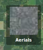
Open:
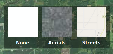
Showing the toggle open
Installing
Copy
basemap-toggle.jsfromexamples/plugin/srcto the same directory asapp.js.Before
<script type="text/javascript" src="app.js"></script>add the line:<script type="text/javascript" src="basemap-toggle.js"></script>
Add a target
divfor the plugin:Change:
<div id="map-container">
    <div id="map"></div>
</div>
To:
<div id="map-container">
    <div id="map"></div>
    <div id="layer-toggle"></div>
</div>
The following can be added to the Demo’s
app.jsto demonstrate how the basemap toggle is configured. An actual application will have different layer names, paths, and preview images.Add the following before
tracker.startTracking();:app.experimental.addConnectedPlugin(BasemapToggle, 'layer-toggle', { layers: [ { label: 'None', src: 'data:image/gif;base64,R0lGODlhAQABAIAAAP7//wAAACH5BAAAAAAALAAAAAABAAEAAAICRAEAOw==', path: 'none/none', }, { label: 'Aerials', src: 'https://demo.geomoose.org/cgi-bin/mapserv7?SERVICE=WMS&VERSION=1.1.1&REQUEST=GetMap&FORMAT=image%2Fjpeg&LAYERS=mncomp&MAP=%2Fsrv%2Fdemo%2Fsrc%2F3.0%2Fgm3-demo-data%2F.%2Fdemo%2Fwms%2Fwms_proxy.map&SRS=EPSG%3A3857&STYLES=&WIDTH=40&HEIGHT=40&BBOX=-10389135.541557081%2C5535452.120985681%2C-10351566.742154919%2C5566447.33595532', path: 'lmic/mncomp' }, { label: 'Streets', src: 'https://a.tile.openstreetmap.org/12/989/1480.png', path: 'openstreetmap/osm_mapnik' } ] });