How-to add a layer
This how-to provides instructions to add the a Firestations layer to the GeoMoose demo. These instructions are similar to those found in the GeoMoose Workshop. There is another similar how to on adding a GeoJSON file to GeoMoose.
Including Firestations from the Demo.
The firestations layer is included with the GeoMoose 3 Demo Data.
Open the
mapbook.xml
For MS4W installs, the mapbook is located here:
C:\ms4w\apps\gm3\htdocs\examples\desktop\mapbook.xml
Add the following after line 5:
<map-source name="firestations" type="mapserver">
    <file>./demo/firestations/firestations.map</file>
    <layer name="fire_stations"/>
</map-source>
The above XML adds the
firestationssource with afire_stationslayer.
Add Firestations to the catalog
GeoMoose separates the difference between the source-data with
<map-source />es and presentation with the use of the<catalog>.In
mapbook.xmlfind the<catalog>element, after it, add:<layer src="firestations/fire_stations" title="Firestations"/>
This will add the
fire_stationslayer of thefirestationssource to the catalog with the label “Firestations”.“Hard” Reload the Browser or clear-the-cache and reload. Pro tip: Chrome can be very aggressive at caching AJAX loaded XML.
The catalog should now have a ‘Firestations’ layer at the top!
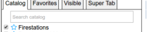
Firestations in the catalog
Using identify with Firestatations
The:doc:./add-identify guide features the firestations layer. And describes adding identify and how identify works.