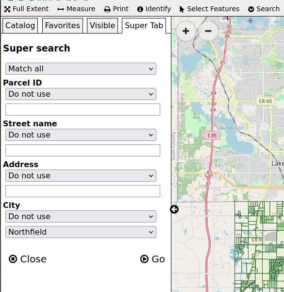
How-to add a multi-field complex search
The code below shows a very complex example of a data search that is intended for power users. It uses GeoMoose’s demo-parcel layer.
Configure the search service
In app.js, a new search service needs configured for that layer:
// The `operators` array is a handy short cut
//  for setting search options below.
const operators = [
  {value: '', label: 'Do not use'},
  {value: 'ilike', label: 'Similar to'},
  {value: 'eq', label: 'Equal to'}
];
// Register the new "super search"
app.registerService('search-super', SearchService, {
    // set the title for use in the super-tab.
    title: 'Super search',
    // specify the vector-parcels dataset.
    searchLayers: ['vector-parcels/parcels'],
    // This configures the form for the user to use to search.
    fields: [
      {type: 'select', label: '', name: 'and_or', options: [
        {value: 'and', label: 'Match all'},
        {value: 'or', label: 'Match any'}
      ]},
      {type: 'select', label: 'Parcel ID', name: 'pin_op', options: [
        {value: '', label: 'Do not use'},
        {value: 'in', label: 'In list'},
        {value: 'eq', label: 'Is equal to'}
      ]},
      {type: 'text', label: '', name: 'pin_value'},
      {type: 'select', label: 'Street name', name: 'street_op', options: operators},
      {type: 'text', label: '', name: 'street_value'},
      {type: 'select', label: 'Address', name: 'address_op', options: operators},
      {type: 'text', label: '', name: 'address_value'},
      {type: 'select', label: 'City', name: 'city_op',
        options: [
          {value: '', label: 'Do not use'},
          {value: 'eq', label: 'Is equal to'}
        ]
      },
      // These cities are in the parcel dataset in all caps,
      //  this filter uses "eq" which requires the caps and spelling
      //  match the value of the field in the data.
      {type: 'select', label: '', name: 'city_value',
        options: [
          {value: 'NORTHFIELD', label: 'Northfield'},
          {value: 'FARMINGTON', label: 'Farmington'}
        ]
      }
    ],
    prepareFields: function(fields) {
        const query = [];
        // convert the fields into a an object to make
        //   lookup in the loop easier.
        const values = {};
        fields.forEach(function(field) {
            values[field.name] = field.value;
        });
        // the fields names in the form are generic,
        //  this is the list of field names in the datset
        const fieldLookup = {
            pin: 'PIN',
            street: 'STREETNAME',
            address: 'BLDG_NUM',
            city: 'CITY'
        };
        // iterate through the list of generic field names
        ['pin', 'street', 'address', 'city'].forEach(function(input) {
            // check to see if the user specified an operator
            const op = values[input + '_op'];
            // translate the form's field name to the data's field name
            const fieldName = fieldLookup[input];
            // get the value from the user's entry.
            const fieldValue = values[input + '_value'];
            // The "ilike" operator ignores case and allows for partial matches.
            if (op === 'ilike') {
                query.push({
                    comparitor: 'ilike',
                    name: fieldName,
                    value: '%' + fieldValue + '%'
                });
            } else if (op === 'in') {
              // "in" is a meta-operator, it needs converted to
              // an "or" query.
              const values = fieldValue.replace(' ', '').split(',');
              query.push(['or'].concat(values.map(function(value) {
                return {
                  comparitor: 'eq',
                  name: fieldName,
                  value: value,
                };
              })));
            } else if (!!op) {
                // trust that the specified operator exists
                // In this example the only other operator is 'eq'
                query.push({
                    comparitor: op,
                    name: fieldName,
                    value: fieldValue
                });
            }
        });
        // when the user chooses "match any" do an "or" query instead of "and"
        if (values['and_or'] === 'or') {
            return [['or'].concat(query)];
        }
        return query;
    }
});
Add the search service to the toolbar
In the mapbook.xml:
Find the
<toolbar>element.Inside the
<toolbar>element, add the follow entry for the new search service:<tool name="search-super" css-class="tool search" title="Super search" type="service"/>